
By Jim Stefkovich, Meteorologist, Alabama Emergency Management Agency
CLANTON – Tuesday 630 am, September 29, 2026
By late week, the combination of a non-tropical upper-level low pressure system in the northern Gulf and a frontal boundary across the state will produce numerous showers and thunderstorms. Rainfall will begin in the far southern sections Friday and spread across the entire state Saturday through Sunday. The activity will begin to end Monday across the northern half of Alabama but may linger into early Tuesday across the southern half.
Due to cloud cover and weak wind shear, little to no severe weather is expected, but a couple of storms each day could produce wind gusts from 30-40 mph. In addition, it will be much more humid beginning Thursday and continuing through the weekend.
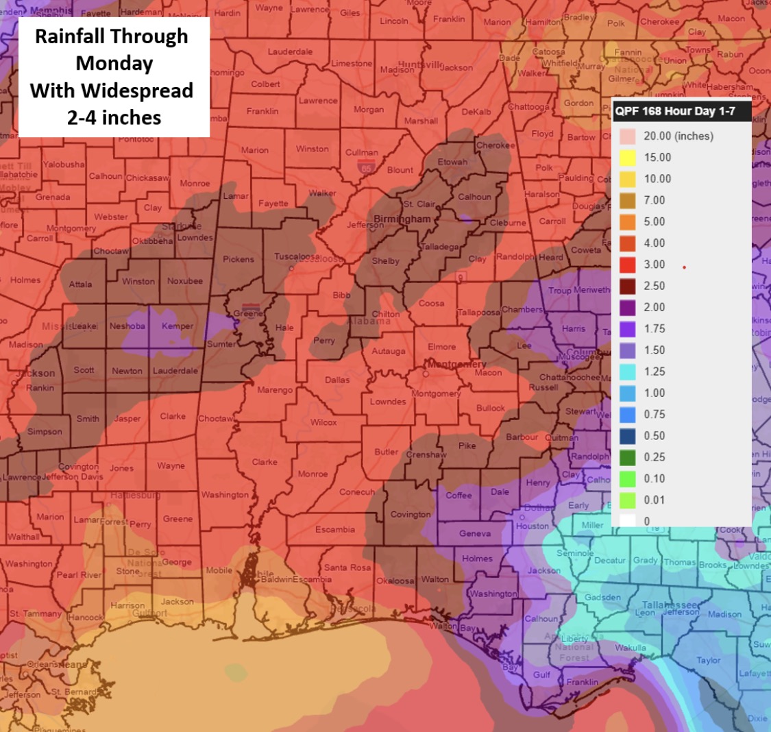
Widespread 2-4 inches of total rainfall are currently forecast through early Tuesday, which is good news for our current drought conditions.
There is a question of exactly where the frontal boundary will stall across the state this weekend. 4+ inch totals are very possible near the boundary before it exits the state next Tuesday, which could lead to localized flooding at times.