
By Jim Stefkovich, Meteorologist, Alabama Emergency Management Agency
CLANTON – Thursday, 2 pm, August 20, 2026
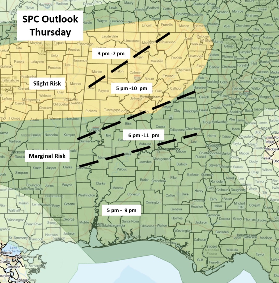
High-resolution models are coming into agreement that clusters or short line segments will form in northern Alabama mid to late afternoon and move southward, rapidly decreasing in intensity by 11 pm once reaching a Livingston – Montgomery – Auburn line.
Due to a very unstable atmosphere, damaging wind gusts and isolated hail will be the main threats. Since the storms will be moving rather quickly, no significant flooding is expected. It is possible a Severe Thunderstorm Watch could be issued for areas near and north of I-20 late this afternoon. There is no tornado threat.
South of a Livingston – Montgomery – Auburn line, isolated to scattered thunderstorms are forecast to develop, with a couple of wind gusts from 40-60 mph possible.
Do not take Severe Thunderstorm Warnings lightly. I’ve heard numerous times during my 40+ weather career people say, “That must have been a tornado with all the damage we had! I never thought thunderstorm winds could do that much damage.”
Make sure you can receive warnings from at least two sources. Unlike Tornado Warnings, most Severe Thunderstorm Warnings DO NOT trigger the Emergency Alert System (EAS). Get inside a sturdy building on the lowest floor possible.