
By Jim Stefkovich, Meteorologist, Alabama Emergency Management Agency
CLANTON – Friday, 730 am, August 21, 2026
A Heat Advisory is once again in effect for a large portion of the state into this evening. Afternoon Heat Index values will reach 106-112 across the advisory area.

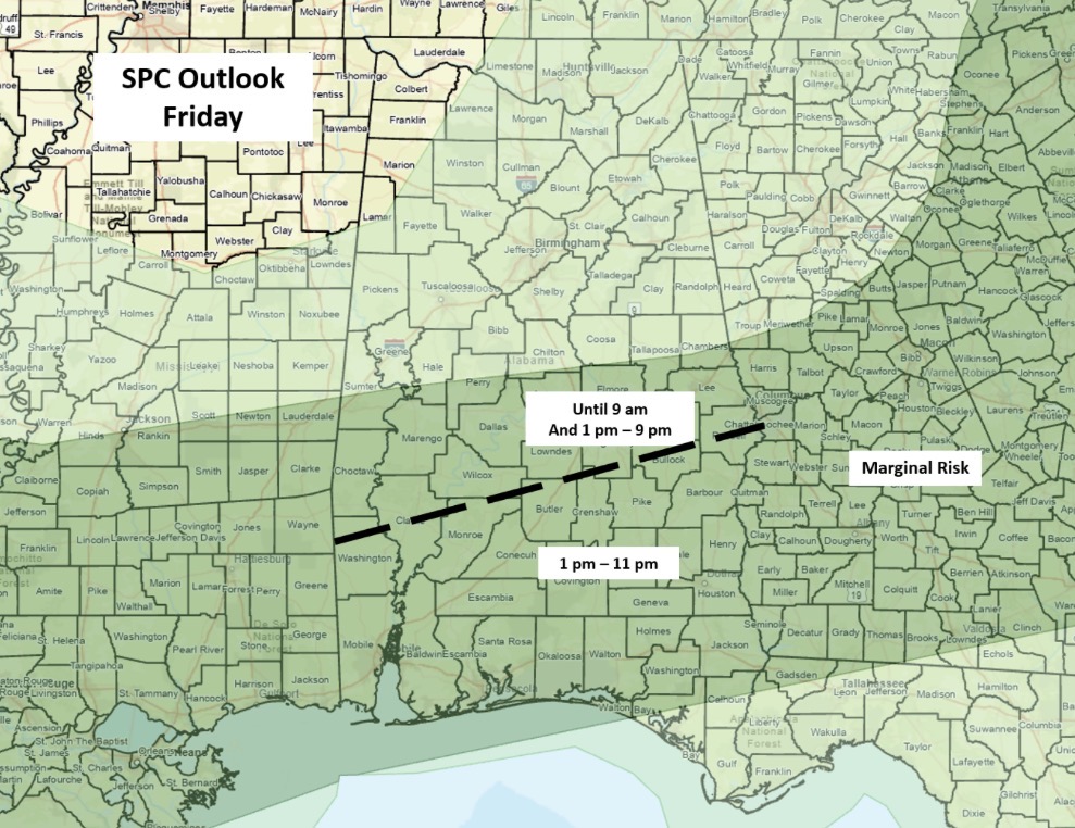
Clusters of storms south of I-20 and generally north of a Livingston – Montgomery – Auburn line may produce a couple of wind gusts from 30-40 mph and very heavy rainfall through 9 am. Current models indicate these storms will be weakening later this morning.
Scattered to numerous showers and thunderstorms will redevelop this afternoon, mainly south of I-20, lasting into the late evening. The threats are a few damaging wind gusts and very heavy rainfall with localized flooding.
Little to no rainfall will occur across Alabama Saturday and Sunday. Beginning on Monday and lasting into the latter part of next week, northwest flow aloft will increase chances of periodic Mesoscale Convective Systems (MCS) moving from northwest to southeast across the state. These smaller systems, with clusters of thunderstorms, can produce severe weather any time of day but are very difficult to predict more than 24 hours in advance.