
By Jim Stefkovich, Meteorologist, Alabama Emergency Management Agency
CLANTON – Monday, 630 am, June 29, 2026
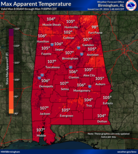
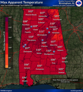
High temperatures through Saturday will be mainly in the middle 90s, except potentially reaching the upper 90s on Tuesday in parts of central Alabama, including the Birmingham metro area. Overnight low temperatures statewide will be in the middle 70s.
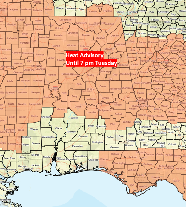
Afternoon Heat Index values will be 100-109 each day, and possibly as high as 111 in parts of central Alabama on Tuesday. Heat Advisory criteria for the southern sections of the state is at least 108 and is forecast to be just below this for the next couple of days.
Heat buildup from successive hot days and very warm nights increases the risk of heat illnesses for those without air conditioning.
Drink plenty of fluids, stay in an air-conditioned room, stay out of the sun, and check up on relatives and neighbors. Children and pets should NEVER be left unattended in vehicles under any circumstances.
No precipitation is forecast today, with isolated to scattered afternoon and evening showers/thunderstorms south of I-59 on Tuesday, the far southern sections on Wednesday, north of I-20 on Thursday, and statewide both Friday and Saturday. A couple of storms each day could produce wind gusts from 40-60 mph, but widespread severe weather will not occur.