By Jim Stefkovich, Meteorologist, Alabama Emergency Management Agency
CLANTON – Monday, 8:00 am, June 1, 2026
As I state every year, the upcoming hurricane season outlook does NOT indicate where storms will form nor ultimately make landfall.
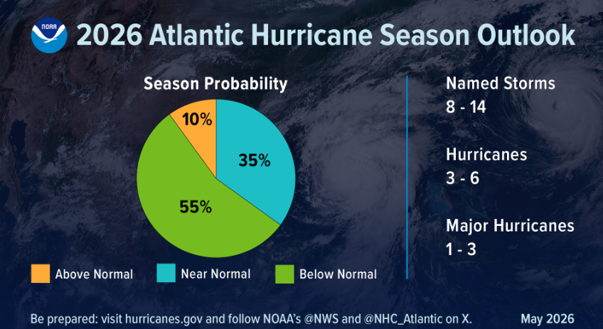
NOAA is predicting a 55% chance of a below-normal season, a 35% chance of a near-normal season, and a 10% chance of an above-normal season. The predictions call for 8-14 named storms (average is 14), 3-6 hurricanes (average is 7), and 1-3 major hurricanes (average is 3).

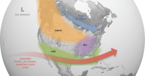
The forecast is driven by competing factors. El Niño is expected to develop and intensify during the hurricane season. El Niño increases the Pacific jet stream (upper-level winds), which tends to disrupt storm formation and/or intensification. On the other hand, slightly warmer-than-normal ocean temperatures are expected, and trade winds closer to the equator will likely be weaker than average.
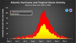
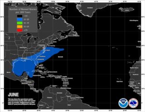
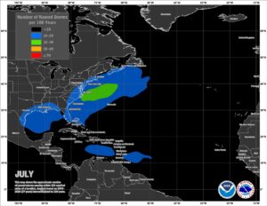
The climatological peak for tropical activity is September across the entire Atlantic basin, including the Gulf. However, the Gulf Coast states, including Alabama, have the potential for early-season tropical activity in both June and July, which can develop rapidly near the coast with little lead-time before landfall.
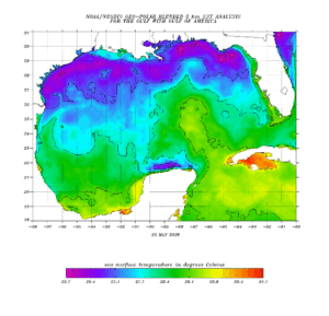
A key ingredient needed for tropical activity is sea surface temperatures at or above 78 degrees Fahrenheit (25.6 degrees Celsius). The Gulf typically warms faster than the Atlantic, and as you can see from the graphic below, Gulf temperatures are already above 25.6 degrees Celsius as of May 25th.
It’s important not to let your guard down or downplay tropical storms and lower category hurricanes, even if you live well away from the coast. Hurricane Danny in 1997 was “just” a Category 1 and occurred in a “super El Niño year”. Over 30 inches of rain fell in Mobile and Baldwin counties with gusts near 100 mph.
In 2024, Helene produced devastating flooding as far north as Ohio and Virginia.

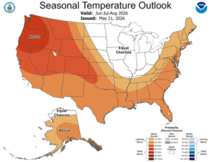
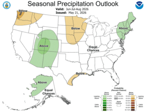
Finally, what is the long-range summer forecast for Alabama, June through August? Above normal temperatures and normal rainfall.
Although rainfall during the past week has certainly helped, the state is still in the grips of a significant drought. Dry soil conditions can lead to above-normal temperatures. Think of it this way. Just as the evaporation of sweat from your skin is a cooling process, the evaporation of soil moisture does the same for the atmosphere.
If the soil is dry, both overnight and afternoon high temperatures tend to be higher than normal.
Concerning precipitation, outside of tropical activity (widespread), our precipitation is more “hit and miss”, with afternoon and evening thunderstorm activity. Although isolated spots can receive heavy rainfall, the precipitation is typically much less widespread.