By Jim Stefkovich, Meteorologist, Alabama Emergency Management Agency
CLANTON – Saturday, 7:30 am, June 20, 2026
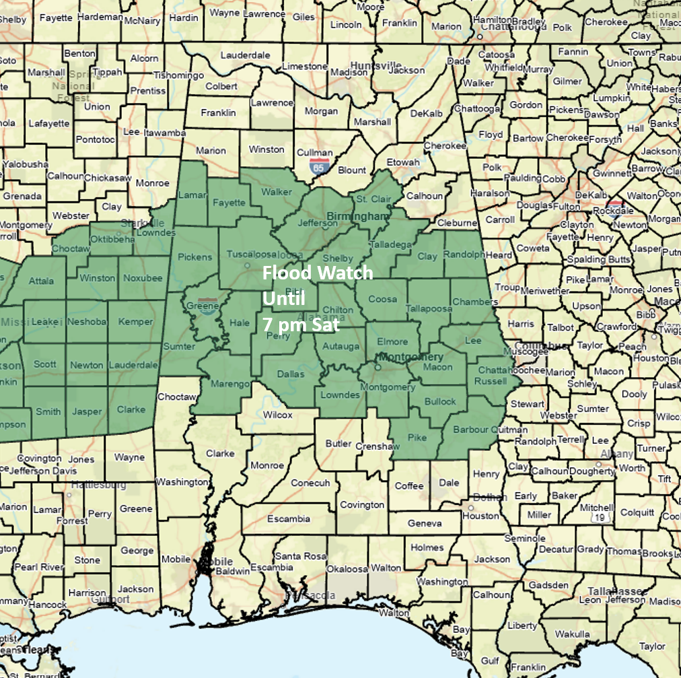
A Flood Watch has been extended until 7 pm today for most of central Alabama.
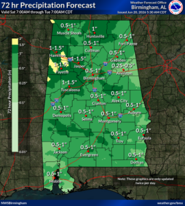
An active pattern will continue through at least Wednesday of next week, albeit with breaks in rainfall each day. For today, a large area of rain and thunderstorms will move west to east across much of the state, beginning in the western sections after 8 am and exiting the eastern sections before midnight.
Although generally an inch or less of total rainfall is expected through tonight, some spots could receive 1-3 inches. Any significant rainfall on top of already saturated soil conditions could produce flooding very quickly. In addition, a couple of storms could produce wind gusts from 40-50 mph.
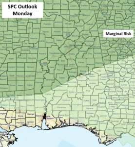
Scattered to numerous showers and a few thunderstorms are forecast across the state Sunday afternoon and evening. We then transition to northwest flow aloft with the potential for Mesoscale Convective Systems (MCS) to move from northwest to southeast across Alabama. One MCS is expected Monday afternoon and evening, and a Marginal Risk is in effect for a large portion of the state.
Additional MCS may occur Tuesday into Wednesday, but timing and exact locations are highly uncertain this far in advance.