By Jim Stefkovich, Meteorologist, Alabama Emergency Management Agency
CLANTON – Wednesday, 1200 pm, June 17, 2026
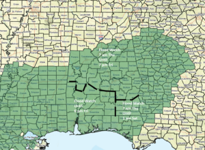
Flood Watches have been issued near and south of I-20.
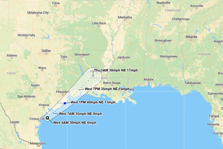
Tropical Storm Arthur has formed in the northwest Gulf; it will move east and make landfall in southeast Texas or southwest Louisiana by this evening.
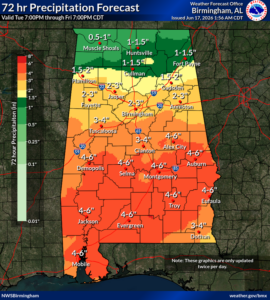
For today, most rainfall will occur across the southern half of the state, with totals of an inch or less. More widespread and heavier rainfall will begin to spread across the state tonight and continue into Friday.
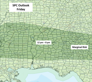
Gusty non-thunderstorm winds from 20-30 mph will occur from Thursday morning through the evening hours, mainly south of I-20. The entire state is under a Marginal Risk for a few severe storm wind gusts up to 60 mph, and perhaps a couple of tornadoes. On Friday, an upper-level disturbance will move across the state, and a few storms may produce wind gusts from 40-60 mph.
Total rainfall through Friday afternoon will generally be 1-3 inches north of I-20 and 3-6 inches south of I-20. However, there will likely be rainbands with torrential rainfall that occur from Wednesday night through early Friday. It is possible that 10-20 inches of total rainfall could fall in some spots.
Unfortunately, scattered to numerous showers and thunderstorms are forecast during the afternoon and evening hours both on Saturday and Sunday, which will only worsen any ongoing flooding issues.