
By Jim Stefkovich, Meteorologist, Alabama Emergency Management Agency
CLANTON – Monday, 945 pm, June 1, 2026
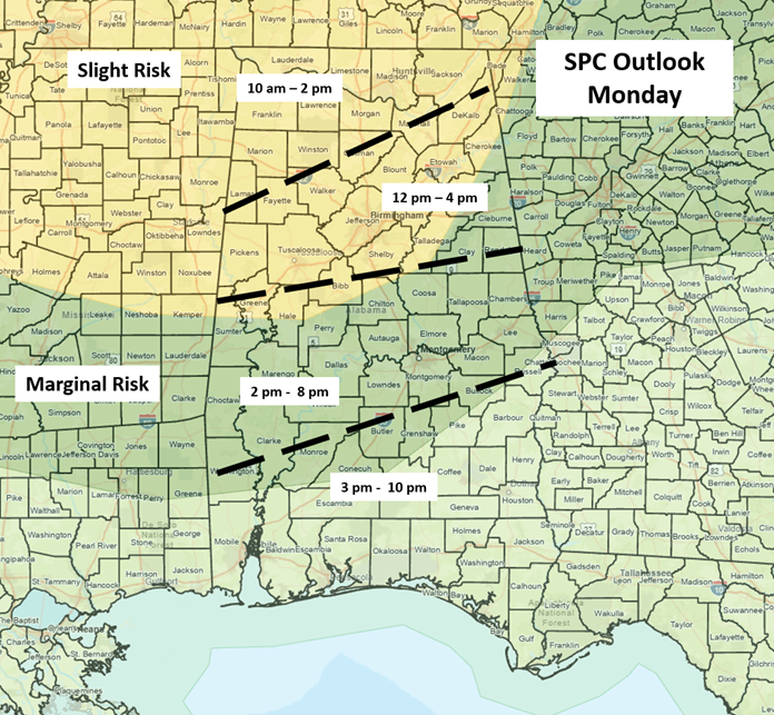
A Mesoscale Convective System (MCS) or small cluster of storms will enter northern Alabama by late morning, move quickly southward, and exit the southern portions of the state by 10 pm. Damaging, straight-line wind gusts and hail are the threats. There is no tornado threat, and due to the fast movement, little to no flooding threat.
Another cluster of storms is possible after midnight, but right now, models have this moving through Mississippi. On Tuesday, scattered to numerous showers and a few thunderstorms are forecast to develop near and south of I-20 during the afternoon and continue into the evening. A couple of storms could produce wind gusts from 40-50 mph.
Wednesday through Saturday morning will be dry across the state, with scattered showers and a few thunderstorms possible, mainly across the western half, Saturday and Sunday afternoons and evenings.