By Jim Stefkovich, Meteorologist, Alabama Emergency Management Agency
CLANTON –Wednesday 700 am, October 7, 2026
Isaias will make landfall Friday night or early Saturday. There will be impacts to portions of the state beginning Friday and lasting into early Sunday, with potential power outages and flooding. NOW is the time to get prepared!
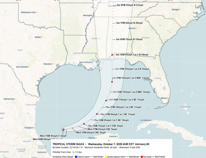
Tropical Storm Isaias is forecast to become a hurricane on Thursday and increase to a Category 2 while over the central Gulf with sustained winds of 110 mph. As Isaias approaches the northern Gulf, it will encounter wind shear, and a slight decrease in wind speed is expected. Still, sustained winds will be between 85 and 95 mph with landfall somewhere from just west of Biloxi, MS to Panama City, FL.
A Hurricane Watch will likely be issued later today.
As landfall is still a couple of days away, expect changes to the information below, and it’s important to keep up with the latest information from official sources like Emergency Management, the National Weather Service and the National Hurricane Center.
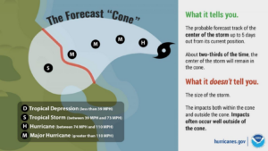
Also, please understand the hurricane track cone represents where the center of circulation is expected. IMPACTS occur well outside of this cone.
Specific impacts to Alabama:
Rainfall
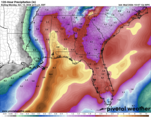
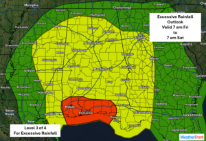
Rainfall will be on the increase Friday morning near the coast and spreading across areas south of I-20 during the afternoon. 2-4 inches of rain is forecast in the far southern sections, with 0.25 – 1.5 inches farther north to I-20 through 7 pm Friday.
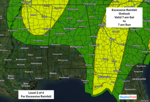
Heavy rainfall, especially in bands, will occur across the state from Friday night through Saturday night. Rain will end across the western half of Alabama Sunday morning and the eastern half during the afternoon.
By Sunday evening, there will likely be areas of 4-8 inches of total rainfall, with the potential for double these amounts. Flooding appears likely, especially across the far southern sections.
Tornadoes
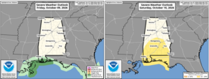
First, concerning tornadoes, the SPC has issued an outlook for coastal Alabama for a risk of tornadoes on Friday, and the southern half of the state Saturday.
Wind
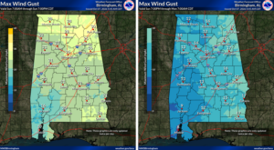
Concerning winds from Isaias, gusts of 25-35 mph will occur during the day Friday south of Livingston – Montgomery – Eufaula line. From Friday night into early Saturday, there will be gusts over 80 mph in the far southern sections, with gusts from 35-60 mph north of this to a Livingston – Montgomery – Eufaula line.
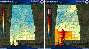
On Saturday, gusts will range from 35-45 mph south of I-20 and as high as 60 mph near the center of circulation. North of I-20, gusts will range from 30-40 mph.
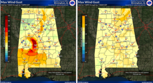
Sunday will see an end to the wind impacts, but it will still be breezy with gusts from 20-30 mph north of I-20 through the morning hours.