
By Jim Stefkovich, Meteorologist, Alabama Emergency Management Agency
CLANTON –Friday 415 pm, October 9, 2026
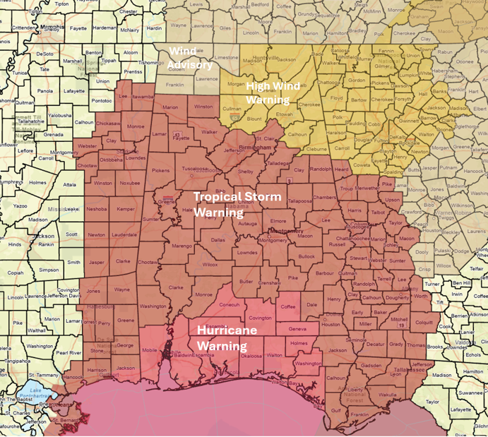
A Hurricane Warning is in effect for Mobile, Baldwin, Escambia, Conecuh, Covington, Coffee and Geneva counties, with a Tropical Storm Warning extending northward to the I-22/I-20 corridor.
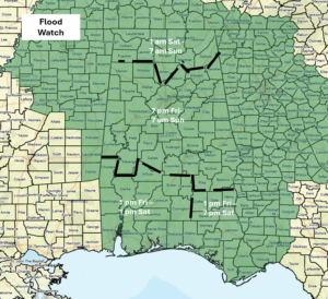
A Flood Watch is in effect south, central after 7 pm and north after 1 am.
Beginning at 1 am, a High Wind Warning is in effect for the northeastern sections, with a Wind Advisory in the northwest.
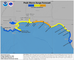
Storm surge from 4-6 feet could occur along coastal areas, 3-5 ft in lower Mobile Bay and 2-4 ft in upper Mobile Bay tonight into early Saturday.
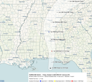
As of 4 pm, Isaias is a Category 3 Major Hurricane with sustained winds of 115 mph. Hurricane-force-winds extend outward 35 miles from the center, with tropical-storm-force winds extending 205 miles from the center.
Landfall is still forecast between 9 pm and 12 am between Pensacola and Santa Rosa Beach, Florida, as a Major Hurricane with sustained winds of 115 mph and higher gusts.
Isaias will remain a hurricane into south-central Alabama and a tropical storm through most of the state until it exits Alabama Saturday evening.
Widespread damage and power outages are likely as this system passes through the state. All actions to protect property should have already been completed for the southern half of Alabama and should be completed across the northern half by 10 pm.
Specific impacts:
Rainfall
Rainfall will start along the coast and spread over the entire state tonight. The bulk of the precipitation will end across the southern half of the state by Saturday evening, and the northern half by Sunday afternoon. No rain is forecast from Monday through at least next Thursday.
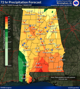
Total rainfall for the event will likely be 1-4 inches across much of the state, with 4-6 inches in the far southern sections. In addition, there is the potential for double these amounts in spots, which could result in some flooding.
Wind
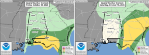
There is a risk for a few tornadoes in the southern sections through tonight, generally south of a Livingston – Montgomery – Eufaula line, and possibly near the Alabama/Georgia state line on Saturday.
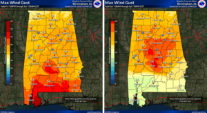
Although sustained winds from Isaias will decrease rapidly after landfall, they will remain destructive, sustained at 60-70 mph near the center of circulation as it moves into south-central Alabama around 7 am Saturday, around 50 mph as it reaches I-20 around 1 pm, and 35-40 mph as it exits the state during the evening hours. There could be higher gusts at times as the center moves through the state.
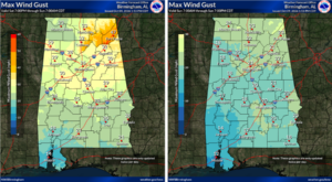
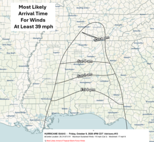
Winds of at least 39 mph have already reached the coast, will reach a Livingston – Montgomery – Auburn line between 12 am and 2 am, and 8 am tomorrow near I-20.