By Jim Stefkovich, Meteorologist, Alabama Emergency Management Agency
CLANTON –Thursday 600 am, October 8, 2026
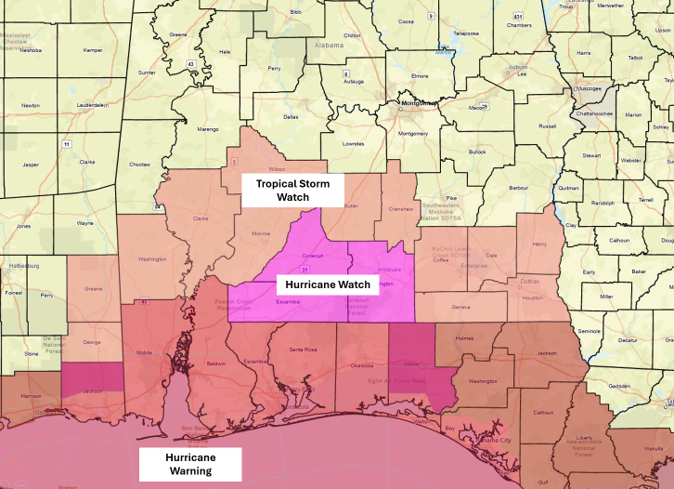
A Hurricane Warning is now in effect for Mobile and Baldwin counties with both a Hurricane Watch and Tropical Storm Watch farther inland.
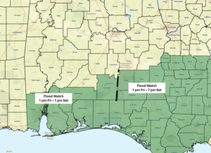
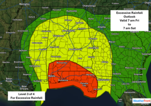
There is also a Flood Watch beginning Friday afternoon in the far southern sections of the state.
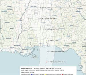
As of 4 am, Isaias is now a hurricane. Here are the NHC changes since yesterday’s forecast:
Landfall is still expected between Biloxi, MS and Panama City, FL Friday evening with wind speeds of 95-105 mph.
Isaias will rapidly drop to tropical storm-force winds of 65 mph soon after landfall very early Saturday morning.
After landfall, the track has shifted westward, with the center moving across western Alabama or eastern Mississippi Saturday morning into early evening.
Specific impacts:
Rainfall
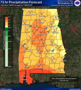
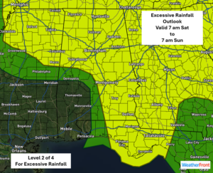
Rainfall will be on the increase Friday afternoon near the coast and spread northward through the evening hours. Widespread rainfall will occur from Saturday morning into the evening hours, except for the southwestern sections where rainfall will likely end by Saturday afternoon.
By Sunday evening, there will likely be areas of 2-4 inches total rainfall across much of the state, with 3-6 inches in the far southern sections where the Flood Watch will occur. In addition, there is the potential for double these amounts in spots, which would result in flooding.
Tornadoes
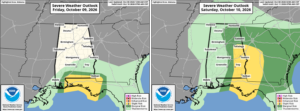
There is a risk for a few tornadoes in the far southern sections on Friday and the eastern half of the state on Saturday.
Wind
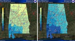
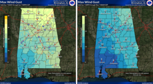
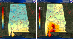
Concerning widespread winds from Isaias, gusts of 25-35 mph will occur during the day Friday south of Livingston – Montgomery – Eufaula line. From Friday night into early Saturday, there could be gusts over 80 mph in the far southern sections, with gusts from 35-60 mph north of this to a Livingston – Montgomery – Eufaula line.
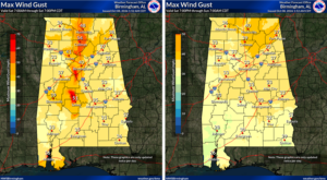
On Saturday, gusts will range from 25-40 mph and as high as 50 mph near the center of circulation. This could result in areas of downed trees and power outages much farther inland.
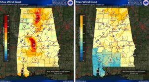
Sunday will see an end to the wind impacts, but it will still be breezy north of I-20 with gusts from 20-30 mph into the afternoon hours.
All rain and wind impacts will end statewide by Sunday evening, and no rain is forecast for much of next week.