
By Jim Stefkovich, Meteorologist, Alabama Emergency Management Agency
CLANTON – Thursday 530 am, October 2, 2026
Scattered to numerous showers and a few thunderstorms will move inland from the Gulf for most of the day, mainly affecting the southern half of Alabama. Activity is likely to decrease overnight, with redevelopment statewide on Saturday.
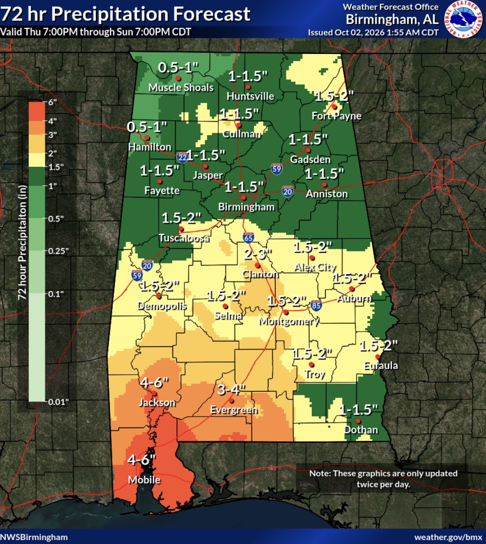
More widespread precipitation is expected Saturday night through Sunday evening. Scattered showers and a few thunderstorms will likely continue Monday south of I-20.
Total rainfall amounts through Sunday afternoon will generally be 0.5 – 1.5 inches north of I-20, 1.5 – 4 inches south of I-20, with 4 – 6 inches near the coast. An additional 0.5 -1 inch is possible across the far southern sections Sunday night through Monday afternoon.
There could be locally higher amounts, especially across the southern half of the state, and some flooding is possible both Saturday and Sunday. There will not be an organized threat for damaging wind gusts during this event.
Cooler and drier air will filter into the state on Tuesday through next Friday.