By Jim Stefkovich, Meteorologist, Alabama Emergency Management Agency
CLANTON – Saturday, 7:00 am, May 9, 2026
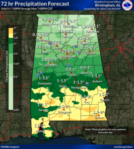
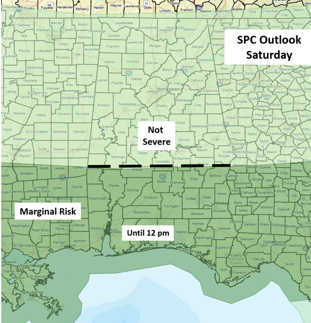
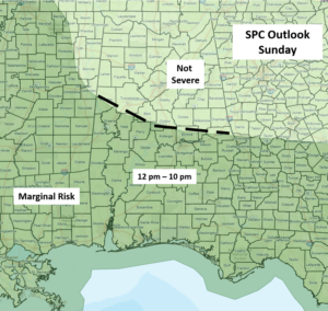
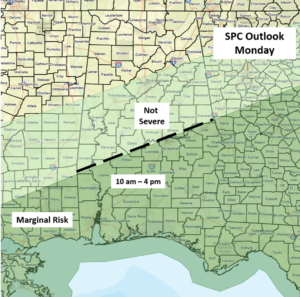
Several upper-level disturbances will move across the state from this morning through Monday morning. The heaviest rainfall and chances for a few strong to severe storms will mainly be across the southern half each day. Although timing graphics are provided below, these may change in later updates depending on exactly when each disturbance will affect Alabama.
A few wind gusts from 40-60 mph and hail to quarter size are the main threats. In addition, stronger storms may also produce brief, localized flooding. Widespread severe weather will not occur, and there is no tornado threat at this time.
Total rainfall amounts through Monday afternoon will generally be 1-2 inches across the southern half of Alabama, with 0.5 inch or less across the northern half.