By Jim Stefkovich, Meteorologist, Alabama Emergency Management Agency
CLANTON – Saturday, 6:30 am, April 25, 2026
A line of thunderstorms in southwestern Alabama, south of Hwy 80 at 530 am, will move eastward through 10 am across the southern portions of the state. A few wind gusts up to 40 mph are possible. Isolated to scattered thunderstorms are forecast to redevelop across the state this afternoon, but no severe weather is anticipated.
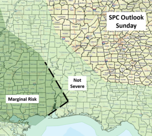
Scattered thunderstorms are forecast from late morning through early evening Sunday west of a Hamilton – Montgomery – Dothan line. A couple of storms may produce wind gusts from 40-60 mph, but widespread severe weather will not occur.
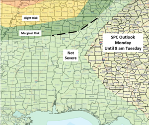
An area of thunderstorms with heavy rainfall will move into the far northern portions of the state after 10 pm Monday and continue southward into Tuesday morning, weakening by daybreak. A couple of wind gusts from 40-60 mph are possible.
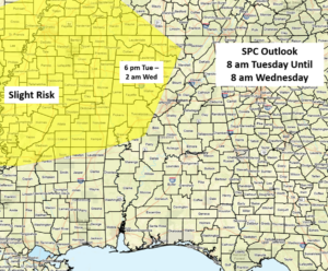
Yet another round of thunderstorms with heavy rainfall and potential severe weather will occur from Tuesday evening into Wednesday morning, as a cluster of storms moves southward out of the Tennessee Valley. The SPC has introduced a Slight Risk area generally west of I-65 and north of I-20.
Although not continuous, additional upper-level systems may result in periods of heavy rainfall and some severe weather potential from next Thursday through the weekend.
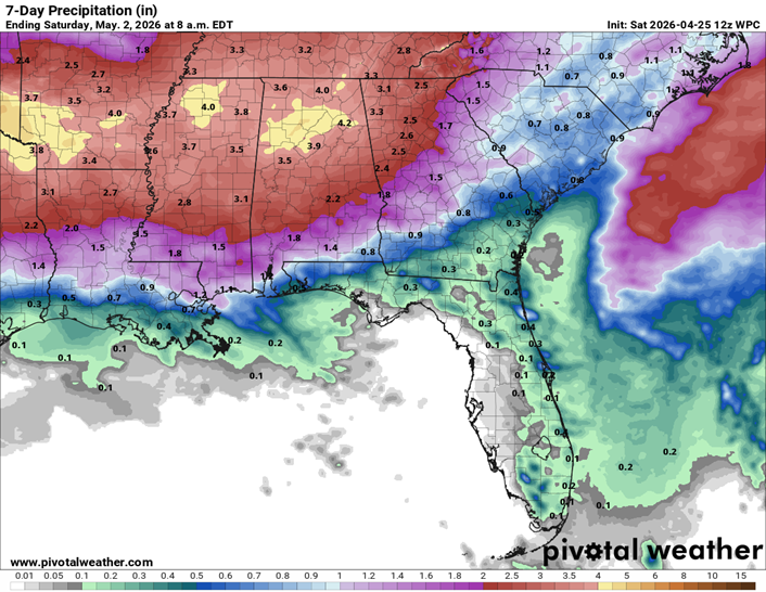
Although beneficial rainfall will occur, total rainfall amounts through next Saturday morning will be 3-5 inches across the northern half of the state, with 1-3 inches over the southern half. As always, locally higher amounts will occur with stronger storms. Flooding may become an issue in some areas, especially by the middle of next week.