CLANTON – Wednesday, 730 am, November 4, 2026
By Jim Stefkovich, Meteorologist, Alabama Emergency Management Agency
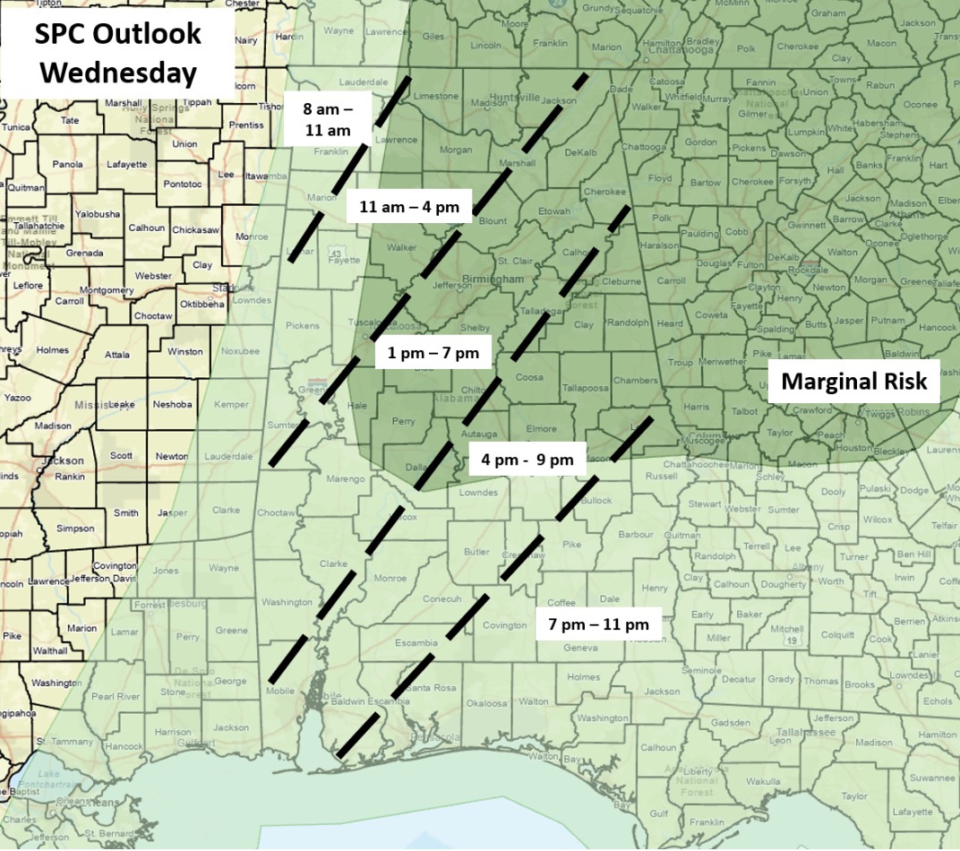
A line of showers and thunderstorms will develop ahead of a slow-moving cold front this morning in the western sections of the state and progress eastward into the evening. Atmospheric instability will increase by late morning into the afternoon, and a few storms could produce wind gusts from 40-60 mph. A tornado or two are also possible.
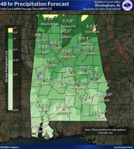
Between 0.5 – 2 inches of rain is expected near and north of I-20, with one inch or less south of I-20. Of course, stronger storms within the line could bring locally higher amounts and isolated, brief flooding potential.
Although a few showers are possible in the far eastern sections Thursday, the remainder of the state will be rain-free with little to no rainfall from Friday into at least the early part of next week.
Much colder air will filter into Alabama Friday, and patchy frost may develop across the northern half of the state both Saturday and Sunday mornings.