
By Jim Stefkovich, Meteorologist, Alabama Emergency Management Agency
CLANTON – Saturday 700 am, October 3, 2026
A Flood Watch is in effect for Mobile and Baldwin Counties from late this morning through Sunday evening.
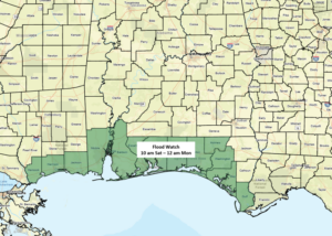
A tropical wave moving across the Gulf through Sunday will funnel very high amounts of moisture into southern Alabama. Intermittent bands of heavy rainfall will push inland today, and a 12 to 18 hour window of heavy rainfall and embedded thunderstorms is likely between this evening and Sunday afternoon, with the greatest focus near the coast. The rainfall may linger into Monday morning. If so, the Flood Watch would need to be extended.
Although unclear right now, there could be the potential for a tornado or two near the coast Saturday night into Sunday.
Farther north, a slow moving cold front will move through the state from north to south Sunday afternoon through Monday afternoon. The bulk of the rainfall for the northern half of Alabama will occur from tonight through Sunday evening.
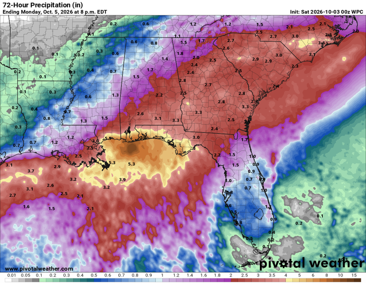
Total rainfall amounts through Monday afternoon will generally be up to 1 inch north of I-59 and 2-4 inches south of I-59, except near the coast where 4-6 inches are forecast. Some locations in the far southern sections of the state could see 6+ inches, and near the coast, potentially 10+.
Drier and cooler temperatures will occur Tuesday through Friday.