By Jim Stefkovich, Meteorologist, Alabama Emergency Management Agency
CLANTON – Tuesday 730 am, September 22, 2026
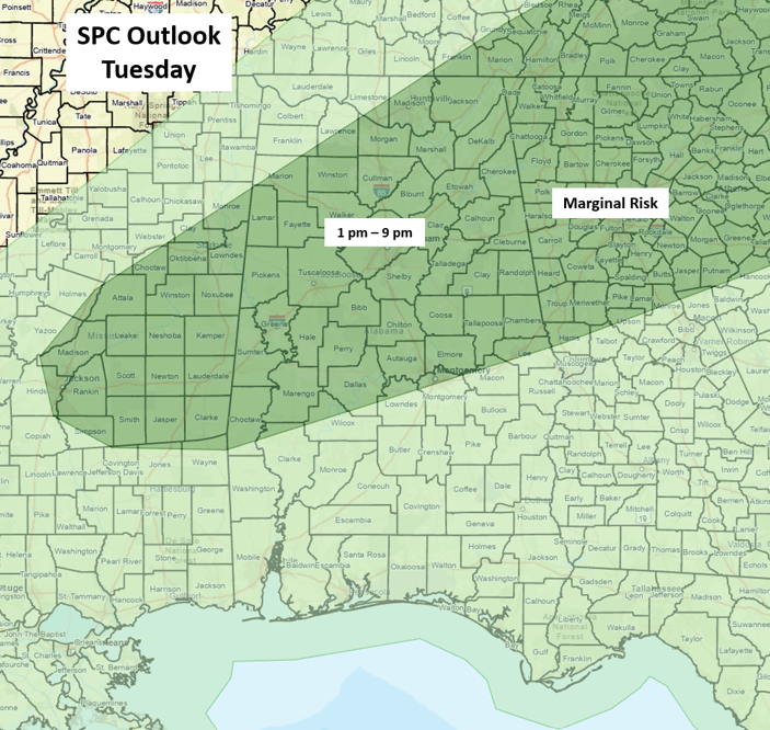
Isolated to scattered showers and thunderstorms will occur across the state this afternoon and last into the evening hours, with the highest concentration of storms in the Marginal Risk area shown in the graphic above.
Isolated wind gusts of 40-60 mph are likely, along with frequent lightning, small hail, and very heavy rainfall in spots, mainly from 1 pm until 9 pm.
On Wednesday afternoon and evening, isolated to scattered showers and thunderstorms are forecast for the eastern half of the state. Otherwise, no rainfall is forecast from Thursday through at least Sunday.
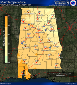
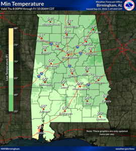
A true cold front will move through the state on Wednesday. By Thursday and continuing through the weekend, high temperatures each day will mainly be in the 80s, with lows in the 50s north and lower to middle 60s elsewhere.