By Jim Stefkovich, Meteorologist, Alabama Emergency Management Agency
CLANTON – Friday, 700 am, August 7, 2026
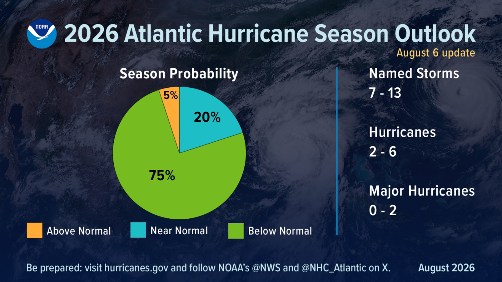
Similar to the NOAA Outlook in May, the updated forecast calls for a 75% chance of below-normal activity, with a 20% chance of a near-normal season, and just a 5% chance of above-normal activity.
The prediction includes 7-13 named storms, 2-6 hurricanes, and 0-2 major hurricanes (Category 3 or higher). A typical hurricane season is 14 named storms, seven hurricanes, and three major hurricanes.
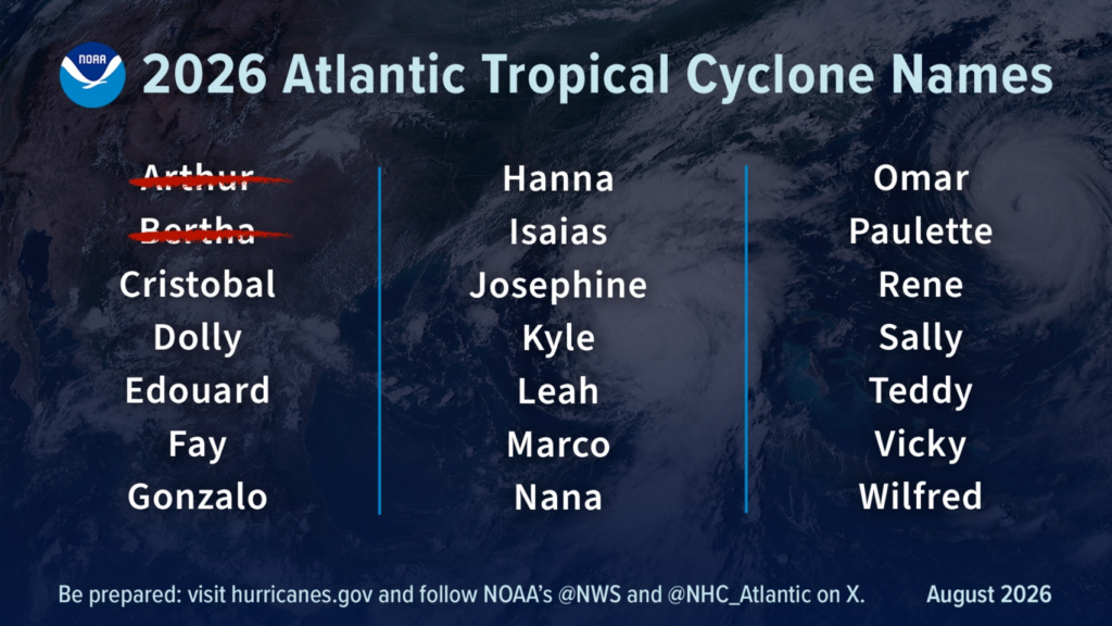
To date, only two named tropical storms have occurred, both in the northern Gulf, and no hurricanes. El Niño not only persists, but is forecast to strengthen through the end of the year, with a 97% chance of lasting through the spring of 2027.
El Niño conditions increase wind shear, which tends to prevent tropical storms from forming or from getting stronger once formed, and is typically the dominant factor during hurricane season.
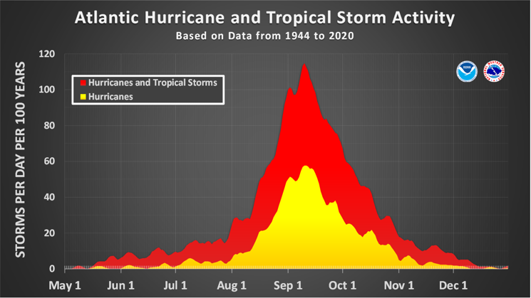
Still, from now through early October, we are in the climatological peak of hurricane season, and the updated forecast does not predict where storms will make landfall. Landfalls are largely determined by short-term weather patterns, which are only predictable about a week in advance.
Closer to home, through at least next Wednesday, Alabama will be in a typical summertime pattern with isolated to scattered afternoon to early evening showers and thunderstorms each day, a couple of which could produce 40-60 mph wind gusts and brief flooding. High temperatures will range from the upper 80s to middle 90s, with lows in the 70s.