Afternoon Memorial Day Update
By Jim Stefkovich, Meteorologist, Alabama Emergency Management Agency
CLANTON – Monday, 100 pm, May 25, 2026
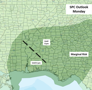
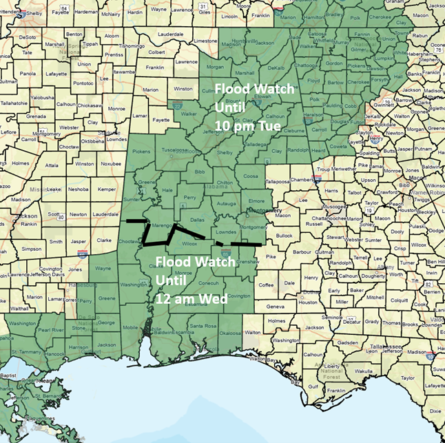
Showers and thunderstorms will continue to increase in coverage across much of the state this afternoon, with a decrease in coverage by 12 am. A few storms through early evening may produce wind gusts from 40-60 mph, and a brief tornado or two is possible near and south of I-20. In addition, very heavy rainfall could lead to some flooding, especially in areas that have received heavy rainfall over the past couple of days.
Another round of showers and thunderstorms is forecast across much of Alabama Tuesday morning or afternoon and will continue into the evening hours. Once again, torrential rainfall in some spots could produce flooding and wind gusts from 40-60 mph.
This trend will continue through this weekend with scattered to numerous showers and thunderstorms each day. There is low confidence in the timing of these disturbances each day, but there will continue to be a threat of very heavy rainfall in stronger storms and strong wind gusts.
Do not attempt to drive through water-covered roads. It takes less water than you might think for your vehicle to lose contact with the roadways. Turn around, don’t drown!