By Jim Stefkovich, Meteorologist, Alabama Emergency Management Agency
CLANTON – Saturday, 7:30 am, February 21, 2026
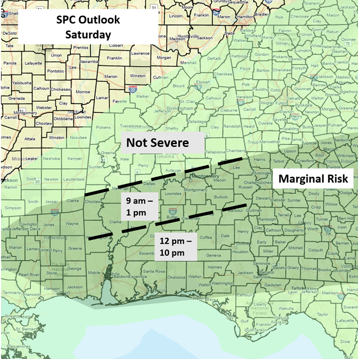
At 6:45 am, a line of thunderstorms along a frontal boundary south of I-20 will continue to move slowly southward today and will not clear the southern portions of the state until this evening. As the storms reach the southern half of the state, instability will increase, and a few wind gusts from 40-60 mph, hail, and possibly a tornado or two are all possible.
Portions of southeastern Alabama may be upgraded to Slight Risk later today if higher instability develops, which would lead to an increased damaging wind threat. Regardless, widespread severe weather is not expected. Total rainfall amounts south of I-20 will be an inch or less, except slightly higher in stronger storms.
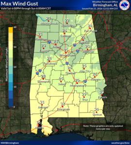
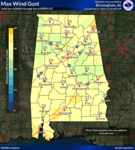
A reinforcing strong cold front will move across the state this evening through tonight. Gusty winds from 15-30 mph will occur from tonight into Sunday evening.
Colder temperatures are forecast Sunday through early Tuesday. Highs on Sunday will range from the 40s north to 50s elsewhere. Lows Monday morning will range from the lower 20s north to middle 30s near the coast. Highs on Monday will only reach the middle 30s north to the lower 50s south. Lows Tuesday morning will again be cold with upper teens north to upper 20s south.
A warm-up will begin on Tuesday, with above-normal temperatures by Wednesday. The next rain-producing system appears to be Thursday into Friday. At this time, there is no threat of severe weather.